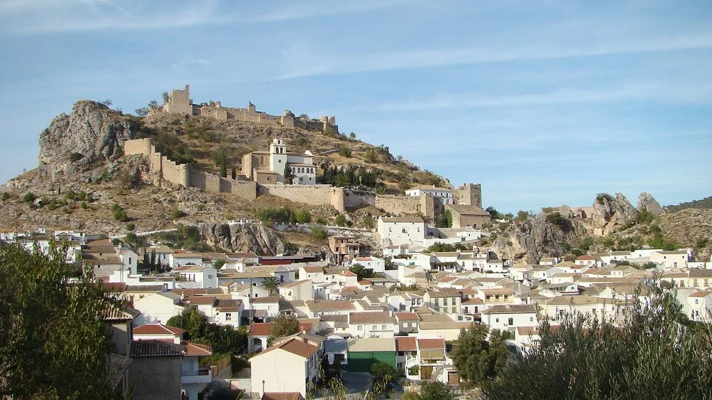
Nívar combines a walk through its church and streets with trips to the Sierra de la Alfaguara. For a short visit, choose the urban center and the viewpoint; If you want to walk more, you can prepare a trip to the Fuente de Nívar or a mountain route. The arrival at the trailhead and the return count separately.
What to choose in Nívar
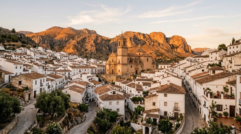
The municipal information places the town in the central-northern part of the Vega de Granada, on the northwest slope of the Alfaguara. It borders with Cogollos Vega, Huétor Santillán, Alfacar and Güevéjar. The Municipal brochure Step by Step helps to locate the resources of the town and its surroundings.
| Plan | What to know | Preparation |
|---|---|---|
| urban walk | Church of Santo Cristo de la Salud, streets and viewpoint. | Check interior opening and choose a route according to mobility. |
| Nivar Fountain | Rural road from Almendros street. | The brochure indicates 2 km one way; add the turn and check the firmness. |
| El Castillejo or Peña de Bartolo | Archaeological site between Nívar and Güevéjar. | Check permitted access and respect the remains. |
| Trenches and Alfaguara | Mountain landscape and heritage of the Civil War. | Choose route, starting point and conditions of the route. |
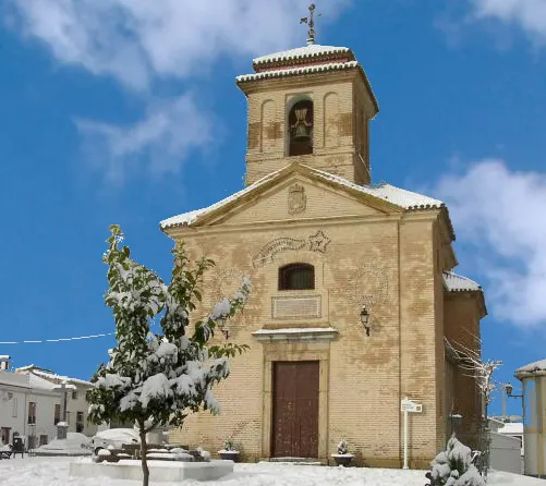
Church of Santo Cristo de la Salud and streets of the town
The municipal brochure describes the church as neoclassical and places its construction between 1779 and 1781. The exposed brick building occupies the main square and can be seen from different sides as it is freestanding. To know its interior, consult the opening and respect the acts of worship.
The same brochure suggests walking along Horno, Eras and Campana streets and approaching Zacatín, behind the church. You can combine this walk with the Nívar viewpoint to see the Sierra de la Yedra, the Vega de Granada and the mountains on the horizon. Visibility depends on time.
If you have a stroller or need to avoid unevenness, ask for a suitable route before leaving. The section between the parking lot or bus stop and the square also counts.
El Castillejo: archaeological site and landscape
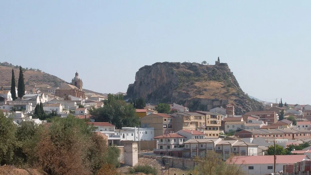
Decree 500/2008 registered El Castillejo, between the terms of Nívar and Güevéjar, as an Asset of Cultural Interest with the typology of Archaeological Zone. Its description includes homes, funerary areas and silos, with materials that place the documented phases between the 6th and 12th centuries.
The municipal brochure also calls it Peña de Bartolo. Your interest is in the settlement and the landscape: check the location and permitted access before climbing, follow the indicated paths and respect the archaeological remains. Avoid entering excavations or moving stones and materials.
Fountain of Nívar: also prepare the return
The brochure suggests leaving Calle Almendros and following a rural road to the Fuente de Nívar, also called Fuente del Cerezo. Publish 2 km one way and low difficulty. If you return the same way, add another 2 km; Reserve margin for rest and road conditions.
It describes tables under the trees and an area of tuffs along the route. Bring drinking water, check the signage at the fountain before drinking, and preserve the natural formations. Check the condition of the road and your mobility needs before choosing it.
Trenches, Carialfaquí and Alfaguara
The section on municipal active tourism links routes such as Camino Carialfaquí, Vereda de la Yedra, Cueva del Agua and Ruta de Trincheras. Its files are hosted on Wikiloc: check the specific route, the date of the description, the gradients and the starting point before following a route.
The municipal brochure dedicates several sections to the positions of the Civil War, including Yedra, Los Pocicos and Cerro Garay. It locates the access to the Yedra trench from the Alfaguara–Fuente de los Potros track, in the surroundings of the Alfaguara Camp. Use the map in the brochure to prepare your arrival and ask about the status of the accesses.
For a first trip to the trenches, choose a complete itinerary or an organized tour and see what areas can be covered. Passages and shelters require attention to the surface, the light and their condition; Don’t confuse the resource map with a single path that links all of them.
The municipal website also mentions the arboretum and the Alfaguara recreational area, within the Sierra de Huétor Natural Park. Check access and restrictions for the day. Bring water and appropriate footwear and keep plenty of light and transportation to return.
Bicycle, climbing and caves
The municipal catalog includes mountain bike routes to Prado Negro, Fuente de la Teja and Cortijo del Chorrillo, as well as climbing areas. Choose an activity according to your experience and check the route, sector, equipment and current conditions.
For the Nívar–Latas chasm complex, the brochure recommends contacting a specialized company and requesting the appropriate permits. Check the conditions of any cave or chasm separately: a walk to its surroundings and an activity inside require different preparations.
How to get there from Granada by bus
The Consortium directory identifies line 305, Granada–Pulianas–Güevéjar–Nívar–Cogollos Vega. You can consult the current schedule and stops for 0305 or the PDF with schedule from September 1, 2026.
Select the day of travel and check the “Nívar” column for both the round trip and the return trip: some services show a dash and do not enter the core. The Consortium indicates that several return services stop on the access road to the town. Confirm the stop and direction in which you should board before organizing your visit.
The current query identifies the line as adapted for people with reduced mobility and asks to contact the operator to confirm adapted transport: 958 202 905. Also check the line notices and the time you need to get from the path or square to the stop.
How to Get to Nívar from Granada, Public Transport & Where to Stay
How to organize the day and municipal contact
For a short outing, combine the square, the streets of the old town and the viewpoint. If you add the Nívar Fountain, prepare the round trip from Almendros Street. If you prefer the trenches or a mountain route, dedicate the plan to that route and add the urban walk only if you have room.
By car, use the exact destination and check where to park without blocking roads or accesses. To eat or stay, check opening times, prices and dietary needs with the chosen establishment.
The City Hall publishes calle Pretiles, 10, 18214 Nívar, the telephone number 958 428 051 and the email address info@ayuntamientodenivar.com. You can ask about the heritage, maps, access and programming for your date.
Sources
- Nívar Town Hall — History, church and situation of the municipality: https://ayuntamientodenivar.com/ayuntamiento-de-nivar/
- Nívar City Council — Active tourism and tour catalog: https://ayuntamientodenivar.com/turismo-activo/
- Transport Consortium, Granada Area — Directory of lines and schedules: https://ctagr.es/horarios-2/horarios-reducidos
- Nívar City Council — Contact and municipal programming: https://ayuntamientodenivar.com/
- Nívar City Council — Step by Step: tourist brochure (PDF): https://ayuntamientodenivar.com/wp-content/uploads/2023/05/completo-WEB.pdf
- Transport Consortium, Granada Area — Line 305: schedule from 09/1/2026 (PDF): https://ctagr.es/wp-content/uploads/horarios/20261001/L0305.pdf
- Transport Consortium, Granada Area — Line 0305: current query, stops and accessibility: https://siu.ctagr.es/es/horarios_lineas_tabla.php?linea=1118
- Junta de Andalucía, BOJA — Decree 500/2008: El Castillejo de Nívar and Güevéjar archaeological zone: https://www.juntadeandalucia.es/boja/2008/237/39
Hiking Trail & Village Day-Trip Calculator (Time & Budget)
Calculate real hiking duration, transport cost from Granada city and local meal budget:
Guided Tours, Free Walking Tours & Tickets in Granada
Book official guided tours, monument tickets, and day trips in Granada with instant confirmation and free cancellation.
Hotels & Stays in Granada
Check live availability, location map, and stays with free cancellation in Granada.