Where should you park for the Ruta de los Bolos river hike in Dúrcal, what footwear do you need, and how long does the trail take? When summer temperatures hit 35 °C in Granada, wading knee-deep through a shaded marble canyon to a mountain waterfall fed by Sierra Nevada snowmelt is the ultimate way to cool down. Here are the verified trail essentials: the Ruta de los Bolos (named after the smooth white marble boulders in the riverbed) is located in Dúrcal in the Lecrín Valley (just 25 minutes south of Granada on the A-44 motorway), entry is 100% free (€0), the out-and-back route covers ~8 km in 3 to 3.5 hours, and sturdy lace-up sneakers or river-trekking shoes that can get wet are mandatory (never wear flip-flops).
How do the main areas compare and which one fits your trip?
That said, once you move from a broad map to the reality on the ground, knowing the exact difference between each sector saves hours of trial and error. In practice, here is how each option compares:
- Tramo Seco / Acequia de Márgena (Inicio – 2,5 km): Paseo fresco junto al canal de agua histórica y bajada al cauce del río Dúrcal; apto todo el año. (Salida desde el Parque de la Estación o Camino de los Bolos · 45 min · Dificultad baja).
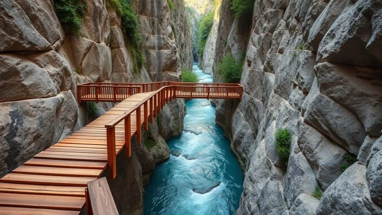
- Tramo Acuático de Los Bolos (2,5 km – 4,5 km): Caminata por dentro del río entre grandes cantos rodados de mármol (‘bolos’), pozas transparentes y estrechos. (Obligatorio calzado acuático con suela adherente (junio–septiembre) · 1h 30m en el agua · Muy refrescante).
- Cascada del Canal de Fuga /Salto de Agua Final: Salto de agua fría de Sierra Nevada donde termina la ruta antes de regresar. (Punto de retorno (ruta lineal de ~8 km ida y vuelta en total) · 3h – 3h 30m total i/v · Gratis (0 €)).
- Puente de Lata de Dúrcal y Baños de Urquízar: Viaducto histórico de hierro diseñado por discípulos de Eiffel y manantial templado a 24 °C. (Combinable en el mismo día en Dúrcal · Gratis (0 €)).
| Area / Option | Best for & key features | Access & parking | Estimated cost (2026) |
|---|---|---|---|
| Tramo Seco / Acequia de Márgena (Inicio – 2,5 km) | Paseo fresco junto al canal de agua histórica y bajada al cauce del río Dúrcal; apto todo el año | Salida desde el Parque de la Estación o Camino de los Bolos | 45 min · Dificultad baja |
| Tramo Acuático de Los Bolos (2,5 km – 4,5 km) | Caminata por dentro del río entre grandes cantos rodados de mármol (‘bolos’), pozas transparentes y estrechos | Obligatorio calzado acuático con suela adherente (junio–septiembre) | 1h 30m en el agua · Muy refrescante |
| Cascada del Canal de Fuga /Salto de Agua Final | Salto de agua fría de Sierra Nevada donde termina la ruta antes de regresar | Punto de retorno (ruta lineal de ~8 km ida y vuelta en total) | 3h – 3h 30m total i/v · Gratis (0 €) |
| Puente de Lata de Dúrcal y Baños de Urquízar | Viaducto histórico de hierro diseñado por discípulos de Eiffel y manantial templado a 24 °C | Combinable en el mismo día en Dúrcal | Gratis (0 €) |
How do you get there by public bus, Metro or car without fines?
In fact, transport and parking logistics are usually the biggest source of stress before setting off. Whether you are travelling from central Granada or along the coast, here are the verified connections:
Located in Dúrcal (Lecrín Valley, 28 km south of Granada via A-44 Exit 157). ~8 km round-trip combining a shaded historic irrigation canal walk (Acequia de Márgena) and wet riverbed trekking. Direct public bus: Metropolitan Consortium Line 360 from central Granada (Palacio de Congresos / Alcázar Genil Metro) to Dúrcal every 30–60 min (~€1.85).
To complete your itinerary with official fares and updated maps, check our companion Granada guides:
How much does it really cost? Let’s run the numbers in euros with a real case
Let’s run the numbers in euros with a real-life example for two adults so you can plan your exact daily budget with zero surprises:
For two adults travelling from Granada for a summer river hike: round-trip fuel or Line 360 bus tickets (~€7.00 total) + Ruta de los Bolos river trek & waterfall swim (€0.00) + waterproof phone pouch (€6.00) + post-hike tapas and cold drinks in Dúrcal (€28.00 for two) totals €41.00 for the couple (€20.50 per person).
What common mistakes should you avoid and what can you combine nearby?
Finally, local experience shows that a few timing rules and reservation checks make all the difference between a seamless day out and unnecessary queues:
- Wear old lace-up running shoes or gripping trail shoes directly in the water, and seal your phone and car key fob inside a dry bag.
- Free access (€0). Park for free in Dúrcal town (near Parque de la Estación / high school) rather than driving down narrow agricultural lanes where turning around is impossible.
- Direct public bus: Metropolitan Consortium Line 360 from central Granada (Palacio de Congresos / Alcázar Genil Metro) to Dúrcal every 30–60 min (~€1.85).
Frequently asked questions before visiting
Where should you park for the Ruta de los Bolos river hike in Dúrcal, what footwear do you need, and how long does the trail take?
When summer temperatures hit 35 °C in Granada, wading knee-deep through a shaded marble canyon to a mountain waterfall fed by Sierra Nevada snowmelt is the ultimate way to cool down. Here are the verified trail essentials: the Ruta de los Bolos (named after the smooth white marble boulders in the riverbed) is located in Dúrcal in the Lecrín Valley (just 25 minutes south of Granada on the A-44 motorway), entry is 100% free (€0), the out-and-back route covers ~8 km in 3 to 3.5 hours, and sturdy lace-up sneakers or river-trekking shoes that can get wet are mandatory (never wear flip-flops).
How much does it really cost? Let’s run the numbers in euros with a real case
For two adults travelling from Granada for a summer river hike: round-trip fuel or Line 360 bus tickets (~€7.00 total) + Ruta de los Bolos river trek & waterfall swim (€0.00) + waterproof phone pouch (€6.00) + post-hike tapas and cold drinks in Dúrcal (€28.00 for two) totals €41.00 for the couple (€20.50 per person).
Verified official sources (2026): Ayuntamiento de Dúrcal (Turismo Valle de Lecrín), Confederación Hidrográfica y Consorcio de Transporte Línea 360 Granada–Dúrcal.
Hiking Trail & Village Day-Trip Calculator (Time & Budget)
Calculate real hiking duration, transport cost from Granada city and local meal budget:
Official sources for further information
These links provide information and notices from organisations connected with the destination. References supporting specific claims appear beside the article text.
Competent municipal administration: official notices, local heritage, registered walking paths, and patron festivals.
Inter-municipal public authority: orange blossom hiking paths, historic watermills, and whitewashed villages.
Official regional public tourism board: hiking paths, cultural itineraries, and certified tourist office network.
Provincial government: municipal technical assistance, historic heritage conservation, and rural sustainability.