Jérez del Marquesado allows you to combine Mudejar heritage, a walk through the town and excursions on the northern slope of the Sierra Nevada. The church of the Annunciation is a reference to start. To walk to Postero Alto or follow the plane rescue trail, prepare a mountain day different from the urban walk.
What to see and how to choose the plan
| Resource | Interest | What to prepare |
|---|---|---|
| Church of the Annunciation | Mudejar coffered ceiling and side doorway. | Confirm access to the interior and respect the cult. |
| Urban area and surroundings | Walk and landscape at the foot of Sierra Nevada. | Choose a route appropriate to the mobility of the group. |
| Mozarabic Way | Alquife–Guadix stage that passes through Jérez. | Distinguish the complete stage from a local section. |
| Postero Alto and airplane trail | Mountain routes with their own routes and demands. | Consult file, meteorology, access and return. |
Church of Our Lady of the Annunciation
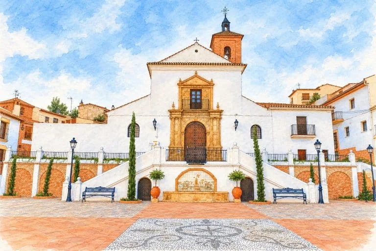
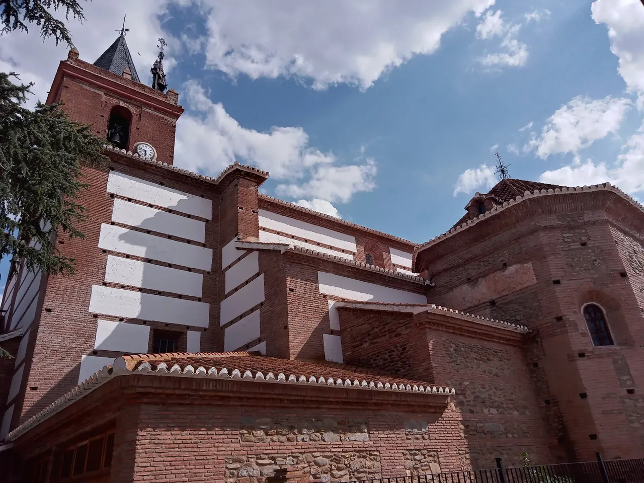
The provincial record of the church identifies it as Our Lady of the Annunciation and places its construction in the first half of the 16th century. He attributes the project to Francisco Antero and the execution to Ambrosio Villegas.
The building has three naves separated by semicircular arches. The central nave preserves a Mudejar coffered ceiling with geometric and polychrome decoration; The side doorway has a semicircular arch framed by attached columns. They are specific elements that you can observe if the interior is open.
Ask about the opening of the interior, entry conditions and visit options with the parish or local information channels. Respect religious celebrations and prepare an outside walk if you cannot enter.
Walk through the town and landscape
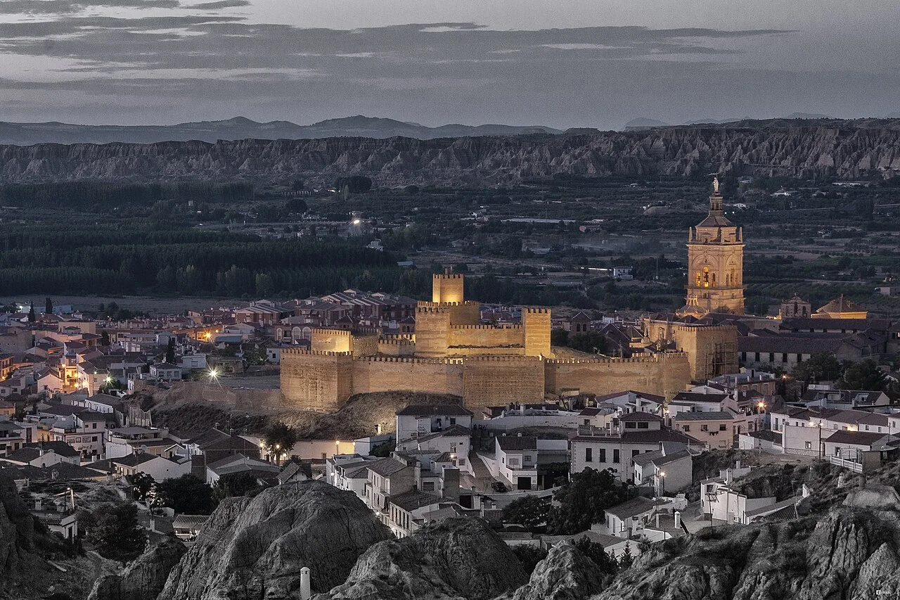
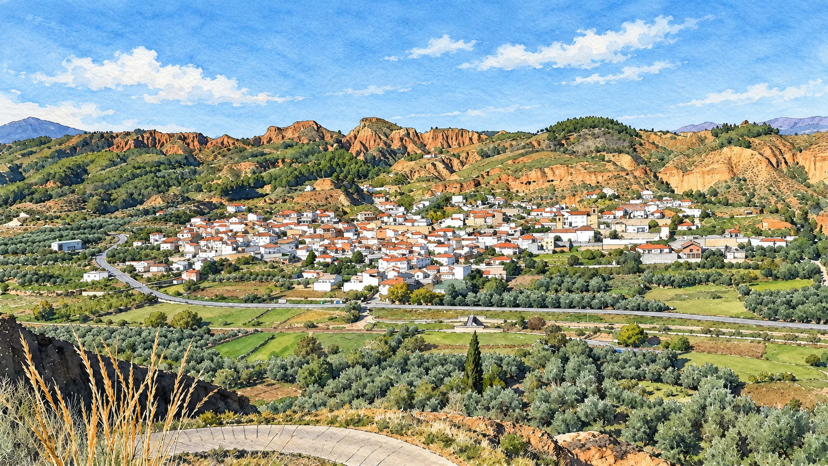
The Guide of the El Avión de la Junta Solidarity Path places the town next to the Alcázar River and highlights chestnut groves, mills and remains of fortifications. You can take that landscape as a starting point to prepare a walk; Check the access to each space you want to visit.
For a first visit, organize a walk through the town and the church, with time to rest and eat. If you want to approach a chestnut grove or irrigation ditch, prepare the specific section, check its access and respect private property. Terrain and water conditions may change.
Mozarabic Road and mining heritage
The Provincial Tourist Board describes the Alquife–Guadix stage of the Mozárabe Way, which passes through Jérez and continues towards Cogollos and Guadix. Its file publishes a distance of 24.39 km for the stage: it is not the length of a walk through Jérez nor does it automatically include the return to your starting point.
The description of the stage mentions the copper mines of Santa Constanza and relates part of the route to the mining landscape. To discover this heritage, choose an authorized tour; Consult before any visit to the interior of farms or galleries.
Hiking: three different proposals
| Tour | Published information | Decision before leaving |
|---|---|---|
| Jérez–Postero Alto | The Board describes it as circular; record with 17,118 m, six hours and high difficulty. | Read the complete route and check unevenness, road surface and return. |
| Rescue of the American plane | Granada Tourism: 23.35 km and nine indicative hours; GPX with departure and arrival at the same point. | Follow the complete chosen route and prepare the mountain conditions. |
| Mozarabic Way Alquife–Guadix | 24.39 km stage according to Granada Tourism. | Organize departure, arrival and transportation; Do not confuse it with a local circuit. |
The Jérez del Marquesado–Postero Alto file ascends through Loma de Enmedio to the refuge and plans to return through La Tizná. The figures on your file are references of the route described, with high difficulty; six hours is not a guaranteed time for any walker.
The path of the rescue of the American plane leaves the Camino del Seminario de San Torcuato and reaches the Paratas de Chorreras Negras, following places linked to the rescue of 1960. The Board’s guide identifies it as PR-A344 and describes the return along the outward path and an alternative through Postero Alto.
The official GPX linked by Turismo de Granada ends at the same point where it begins: its published 23.35 km correspond to the complete route of that file, including the return. If you choose another variant, prepare your distance and return separately. The nine hours on the sheet are indicative.
Before choosing a route, check the map, gradient, trail status, weather, and possible closures. Bring water, proper equipment, and room to return. If there is snow, ice or bad weather, check the conditions with the shelter or a professional service and adapt the outing to the group’s experience.
Postero Alto Refuge: access and contact
The website of the Picón de Jérez–Postero Alto refuge describes the access to the firebreak parking lot: about 1.5 km paved to the BRICA and then about 10.5 km along a dirt track. Check the track status and restrictions before driving on it.
Leave the vehicle in the parking lot and continue walking. The operator describes two approaches: 2.7 km along the firebreak, exposed to the sun and with a steep slope, or 3 km along the path between pine trees that begins about 50 m above the parking lot. Reserve time and effort for that section, both on the way out and back.
The shelter publishes the telephone number 622 762 265 and the email info@refugiopicondejerez.com. Confirm opening, reservation and services for your dates. If you stay overnight, you have shared rooms and bring a sheet bag or light bag, which the operator requires; ask about the right equipment in winter. Take your waste with you: the shelter does not have a collection service.
How to get there and organize the return
Select the town, the shelter parking lot or the exact start of the route as your destination. Check the itinerary and traffic notices. For municipal inquiries, the official DIR3 directory identifies the Town Hall at Plaza Molino, 3, 18518 Jérez del Marquesado, with telephone 958 672 103 and email jerezdelmarquesado@dipgra.es.
On public transport, confirm operator, stop and service for the chosen day, including return. An excursion that ends far from town also needs its own transportation solution.
Eat, sleep and extend the getaway
Choose establishments according to their location and check opening, menu, prices and book directly. If you sleep in a shelter or accommodation outside the hull, calculate access and return separately. Do not assume that an old recommendation is still operational or available.
To combine Jérez with another visit to the Marquisate, prepare the trips and schedules for each resource. If you are looking for parties or a temporary activity, check the official program for your date before booking.
How to Get to Jérez del Marquesado from Granada, Public Transport & Where to Stay
Video: an approach to the Marquisate
Video “Conquer for yourself, El Marquesado, Granada”, from Canal Sur Turismo, as a presentation of the region.
Sources
- Provincial Tourist Board — Church of the Annunciation: https://www.turgranada.es/es/pois/iglesia-parroquial-de-nuestra-se%C3%B1ora-de-la-anunciaci%C3%B3n-4
- Junta de Andalucía — Sendero Solidario El Avión, PR-A344: https://www.juntadeandalucia.es/medioambiente/contenidoExterno/rutasysenderosSierraNevada/sendero-18.html
- Provincial Tourist Board — Camino Mozárabe, Alquife–Guadix stage: https://www.turgranada.es/es/rutas/camino-mozarabe-santiago-alquife-guadix
- Junta de Andalucía — Jérez–Postero Alto circular route: https://www.juntadeandalucia.es/medioambiente/portal/web/ventanadelvisitante/detalle-buscador-mapa/-/asset_publisher/Jlbxh2qB3NwR/content/jerez-del-marquesado-postero-alto/255035
- Provincial Tourist Board — American plane rescue trail: https://www.turgranada.es/es/rutas/sendero-del-rescate-del-avi%C3%B3n-americano?weather=true
- Picón de Jérez–Postero Alto Refuge — Access, equipment and contact: https://refugiopicondejerez.com/el-refugio/
- General Access Point, DIR3 — Jérez del Marquesado City Council: https://administracion.gob.es/espanaadmon/quienesquien/ficha-unidad-organica?selectorServicio=organigramasEstructurasDirectorios&selectorget=L01181089
- Provincial Tourism Board — GPX of the plane route: https://cdn.dipgra.es/my-media-files-bucket/documents/1406283098PRA344_Senderosolidarioelavion1.gpx
Hiking Trail & Village Day-Trip Calculator (Time & Budget)
Calculate real hiking duration, transport cost from Granada city and local meal budget:
Guided Tours, Free Walking Tours & Tickets in Granada
Book official guided tours, monument tickets, and day trips in Granada with instant confirmation and free cancellation.
Hotels & Stays in Granada
Check live availability, location map, and stays with free cancellation in Granada.