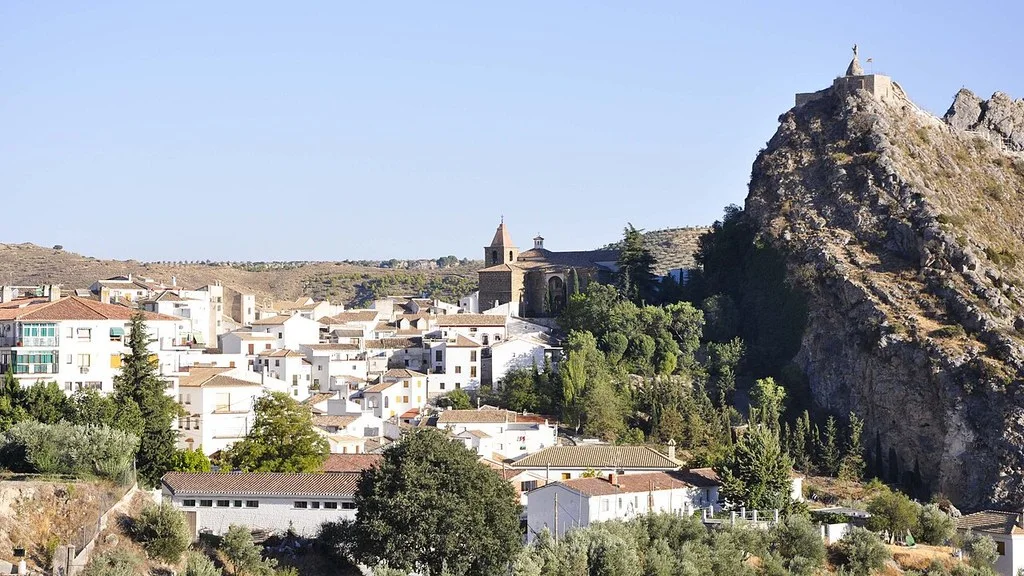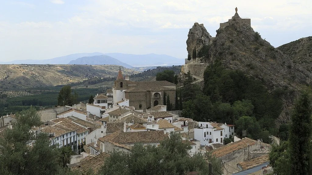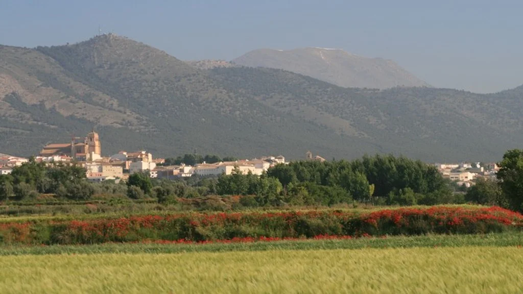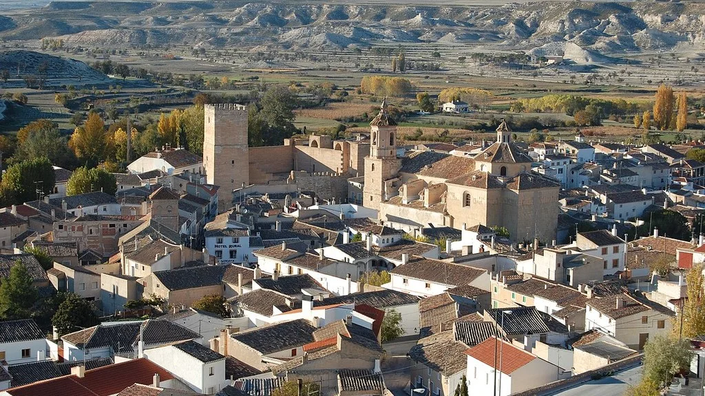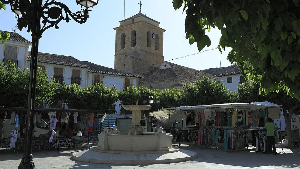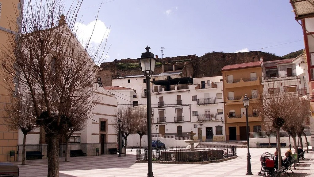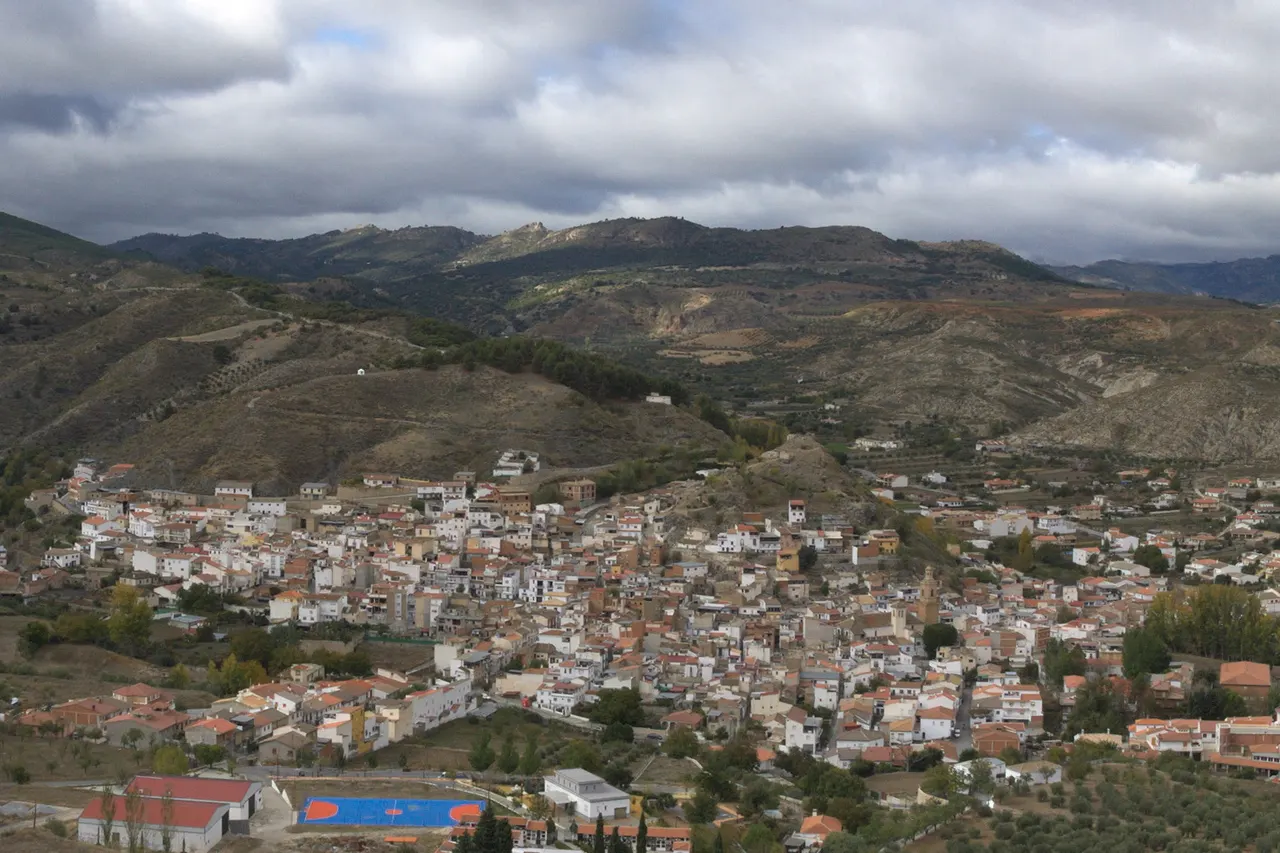
La Peza allows you to combine a walk through fountains and tiles with the church of the Annunciation and the landscape of its medieval fortress. It is in the Guadix region, next to Monte Rosado and facing the north face of the Sierra Nevada, according to the City Hall. Choose an urban tour or an outing in the surrounding area depending on the time and mobility of your group.
| Proposal | What’s included | Posted time or condition |
|---|---|---|
| Route of the Water Sources. | Fountains and corners of the urban center. | Town Hall: about 90 minutes on foot, low difficulty. |
| Blue Jays Route. | Panels about Mayor Carbonero and local memory. | cultural walk; check the route. |
| Route of the Hermitages. | Five stops between the town and its surroundings. | Town Hall: about three hours on foot, low difficulty; there are slopes |
| Mozarabic Way. | Arrival stages from Guadix and continuation to Quéntar. | Independent preparation: layout and current status to be confirmed. |
What to see in the town: church and medieval heritage
The municipal heritage page describes the church of the Annunciation as a Mudejar temple, with a nave covered with wooden armor and a baroque doorway. It distinguishes a first construction in the 16th century, reconstruction in the 17th century and expansion between 1700 and 1738, with a second tower.
Check the opening if you want to visit the church inside and respect the acts of worship. Ask about organized tours and spaces that can be explored before including the interior in your plan.
The same source describes the castle as the remains of a fortress on a rocky height, linked to guarding the road between Guadix and Granada. Identify walls, remains of towers and a cistern. Prepare the visit as an approach to a complex in ruins, with authorized access indicated by the City Council.
Before going up, ask about the route and its conditions. Respect closures and signage, avoid climbing walls and adapt the visit to the terrain. If you need an itinerary without stairs or steep slopes, consult a specific urban alternative.
Route of the Water Sources
The municipal file for the Water Sources Route proposes a walking route of approximately 90 minutes and low difficulty. Add room for stops and check slopes, steps and alternatives if you need an adapted ride.
The description begins at the Charneca fountain, dedicated to Manuel Atienza, Mayor Carbonero, and continues through other fountains in the town. Among them are the Caños Gordos and the Cañillos Chicos, the latter in the Plaza Fernández Castro, also called Placeta de los Cañillos.
Other identified points are the Oficio fountain, which can be reached via Real Street, and the four-spout fountain or the Cruz del Conde fountain. Consult the complete sequence on the card to link the stops and decide where to shorten the ride.
In addition to their ornamental value, the fountains recall the domestic and livestock uses of water. Bring drinking water for the ride and follow the signs at each fountain before drinking. Respect the daily uses of these spaces.
Route of the Tiles and Alcalde Carbonero
The Municipal Route of the Azulejos presents twelve panels distributed along the streets. The story begins in April 1810 and revolves around Manuel Atienza, Mayor Carbonero, the defense of the town and the memory of the oak canyon.
The twelve panels offer a commemorative narrative of Alcalde Carbonero and the Holm Oak Canyon. You can read them during the walk to learn how La Peza preserves and transmits that local memory.
Combine this route with some fountains if you want an urban visit. Check the order and location of the tiles before starting and leave room for stops. To see a festive representation of Mayor Carbonero, you will need to consult his specific call.
Ermitas Route: five stops and slopes
The specific sheet of the Hermitages proposes about three hours on foot and low difficulty. List, in this order, San Anton, San Francisco, Santo Marcos, San Marcos and Santa Lucía. Santo Marcos and San Marcos are different stops.
The description starts from Plaza de España and passes through Cimiento Street and the Cruz del Conde area towards San Antón. It includes slopes, roads and a path to Santa Lucía. Consider the entire route before doing it with children, a stroller, or mobility difficulties.
The route sheet places the current building of San Antón in the sixties, replacing a previous one, and dates Santo Marcos in 1899. These two stops allow us to observe different stages of the local religious heritage.
Ask which interiors are open and which sections are practicable on your date. Wear appropriate footwear, water and sun protection; prepare the return. If you only want to see a hermitage, ask for a specific access instead of starting the entire circuit without sufficient information.
La Peza on the Mozarabic Way
The Spanish Federation of Associations of Friends of the Camino de Santiago includes Guadix–La Peza and La Peza–Quéntar among the stages of the Mozárabe Way of Almería. The stop in the municipality must be organized with the chosen route, accommodation and confirmed supplies.
Check the condition of the Road before leaving. A Federation report published on February 19, 2026, with information from Almería–Granada on the 16th, documented damage and detours in La Peza–Quéntar and Quéntar–Granada after the storms. It is a dated notice: it does not in itself demonstrate which sections are still affected in October or their reopening.
Ask the Jacobean association or the City Council for the updated route and instructions for your date. Respect the closures and marked detours; If a stage is affected, check the alternative before leaving. Confirm your reservation, access and reception hours with the accommodation.
How to Get to La Peza from Granada, Public Transport & Where to Stay
How to organize the visit and return
As a proposal for a visit, start with the urban walk, choose fountains or tiles and add heritage according to openness and mobility. Book another exit if you want to complete the hermitages or a stage of the Camino; Do not add all the routes as if they shared duration and difficulty.
Calculate the road route to La Peza from your origin and check incidents. When parking, follow local signs and leave paths and access roads clear. If you depend on the bus, confirm with the operator the date, stop and last return.
To eat or spend the night, check opening, price and conditions with the chosen establishment. If you are going to walk outside the urban center, prepare your supplies before starting.
The City Hall publishes Plaza de España, 1, 18517 La Peza, the telephone 958 674 151 and the email lapeza@dipgra.es. You can consult heritage, access, itineraries and services.
Sources
- La Peza Town Hall — location and surroundings: https://ayuntamientolapeza.com/
- La Peza Town Hall — church and remains of the castle: https://ayuntamientolapeza.com/historia/patrimonio/
- La Peza City Council — Water Sources Route: https://ayuntamientolapeza.com/conocenos/turismo/ruta-fuentes-del-agua/
- La Peza City Council — Route of the Tiles and Mayor Carbonero: https://ayuntamientolapeza.com/conocenos/turismo/ruta-de-los-azulejos/
- La Peza City Council — Route of the Hermitages: https://ayuntamientolapeza.com/conocenos/turismo/ruta-de-las-ermitas/
- Spanish Federation of Associations of Friends of the Camino de Santiago — stages of the Mozarabic Way: https://www.caminosantiago.org/cpperegrino/caminos/caminover.asp?CaminoId=13
- Federation — storm damage report, February 2026: https://www.caminosantiago.org/cpperegrino/prensa/ifrverprensa.asp?PrensaID=22746
- La Peza City Council — address, telephone and email: https://ayuntamientolapeza.com/contacto/
Hiking Trail & Village Day-Trip Calculator (Time & Budget)
Calculate real hiking duration, transport cost from Granada city and local meal budget:
Guided Tours, Free Walking Tours & Tickets in Granada
Book official guided tours, monument tickets, and day trips in Granada with instant confirmation and free cancellation.
Hotels & Stays in Granada
Check live availability, location map, and stays with free cancellation in Granada.