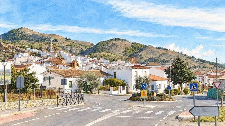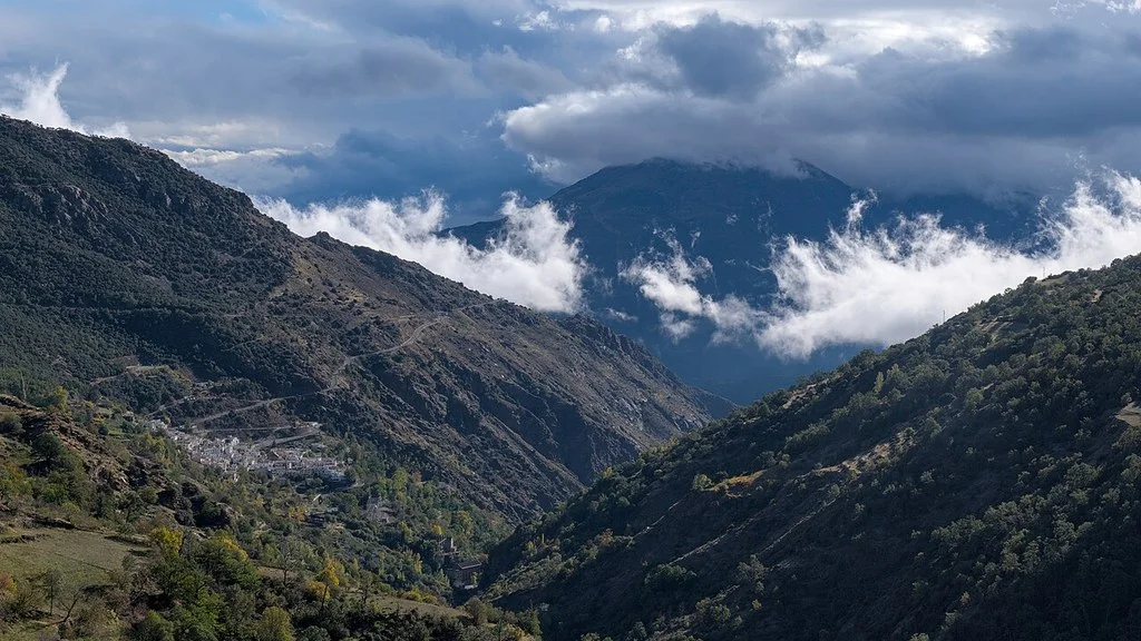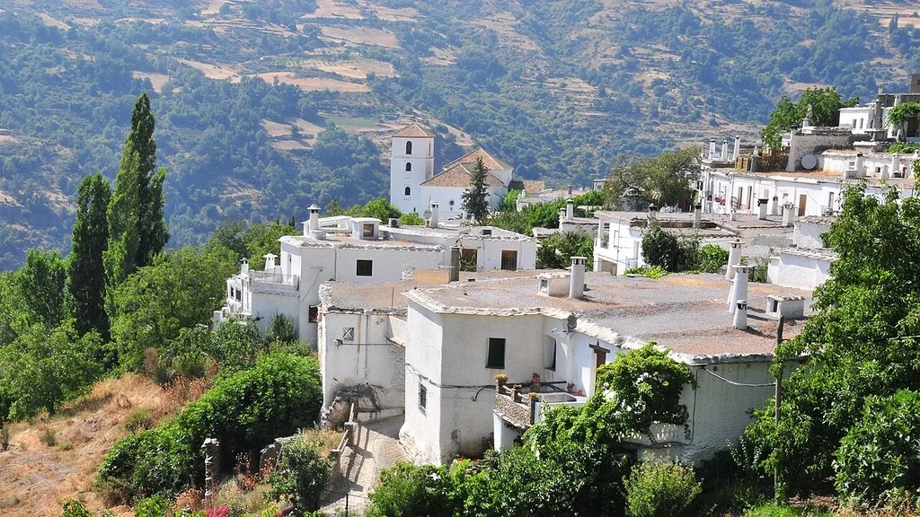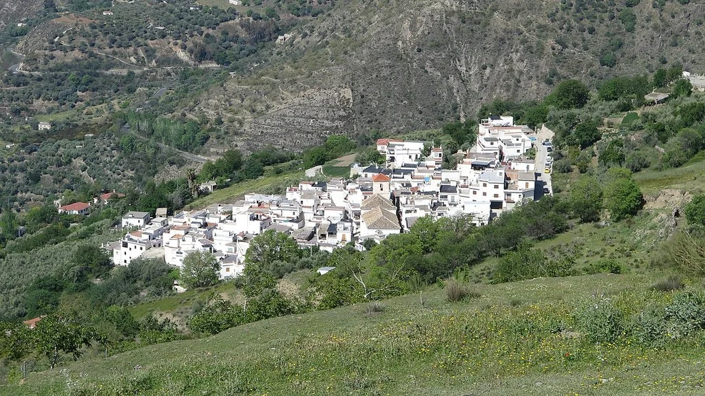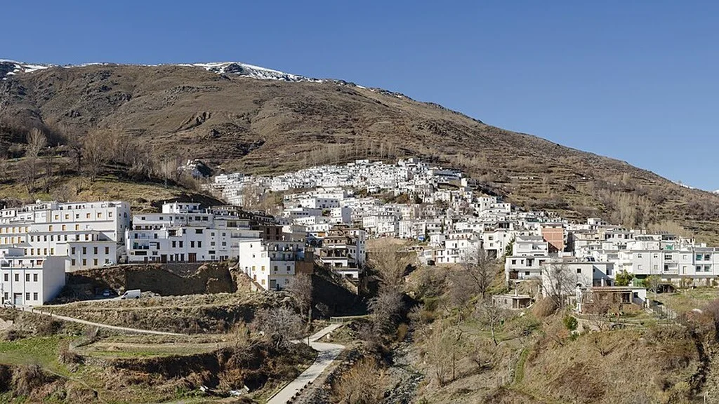
La Taha is a municipality in the Alpujarra of Granada made up of Pitres, Capilerilla, Mecina, Mecinilla, Fondales, Ferreirola and Atalbéitar. Its capital is Pitres. To visit it, choose between a walk through one or two towns and a route that connects them: visiting them all on foot requires different planning.
Its tinaos, washhouses, irrigation ditches and agricultural roads allow architecture and landscape to be combined. First prepare your stops and journeys and check the access points of the interiors you want to visit.
What towns belong to La Taha
The municipal history explains the union of the old municipalities of Pitres, Mecina-Fondales and Ferreirola, with their respective annexes. Decree 881/1972, of March 23,, published on April 12, 1972, approves this merger and establishes the capital in Pitres.
Capilerilla and Capileira are different localities. Capileira, Bubión and Pampaneira are not part of this municipality. Nor Pórtugos and Busquístar, although they may appear on routes and plans in the surrounding area. “Mecina-Fondales” designates the old municipality; Its three nuclei are Mecina, Mecinilla and Fondales.
Choosing the stops: what to see in each nucleus
| Core | References to prepare the trip |
|---|---|
| Pitres | Plaza, church, arcades and neighborhoods. It is the capital and brings together municipal services. Pitres file. |
| Capilerilla | Tinaos, was communal, Binaos fountain with laundry and hermitage of San Francisco de Paula. Capilerilla File. |
| Mecina | It was, a laundry room, a church and old schools that house the CESNA. Mecina Token. |
| Mecinilla | Center close to Mecina with its own identity and traditional architecture. Mecinilla Token. |
| Fundales | Tinaos, sloping streets and surroundings of the Trevélez River. The bridge is outside the hull. Fondales File. |
| Ferreirola | Fountain, laundry room, small squares and tinaos between homes and orchards. Ferreirola file. |
| Atalbéitar | Tinaos, plaza fountain, irrigation ditches, laundry room and threshing floor. Atalbéitar file. |
Use the table to choose the stops that interest you most. Check where to leave the vehicle and how to access the start of the ride. To visit churches or other interiors, check opening and access; When photographing, respect homes, entrances and agricultural work.
Pitres: plaza, arcades and reconstruction
The municipal description of Pitres places the church in the large square and distinguishes neighborhoods such as Hondillo and Alto. It also explains the reconstruction of part of the town after the Civil War: the arcades on the main street recreate models of Alpujarra housing in the 1940s.
Therefore, the traditional appearance does not mean that all preserved buildings are medieval. You can start with the square and arcades and extend the walk through the neighborhoods according to your time and mobility. Confirm opening if you wish to enter the church.
Architecture, water and agricultural heritage
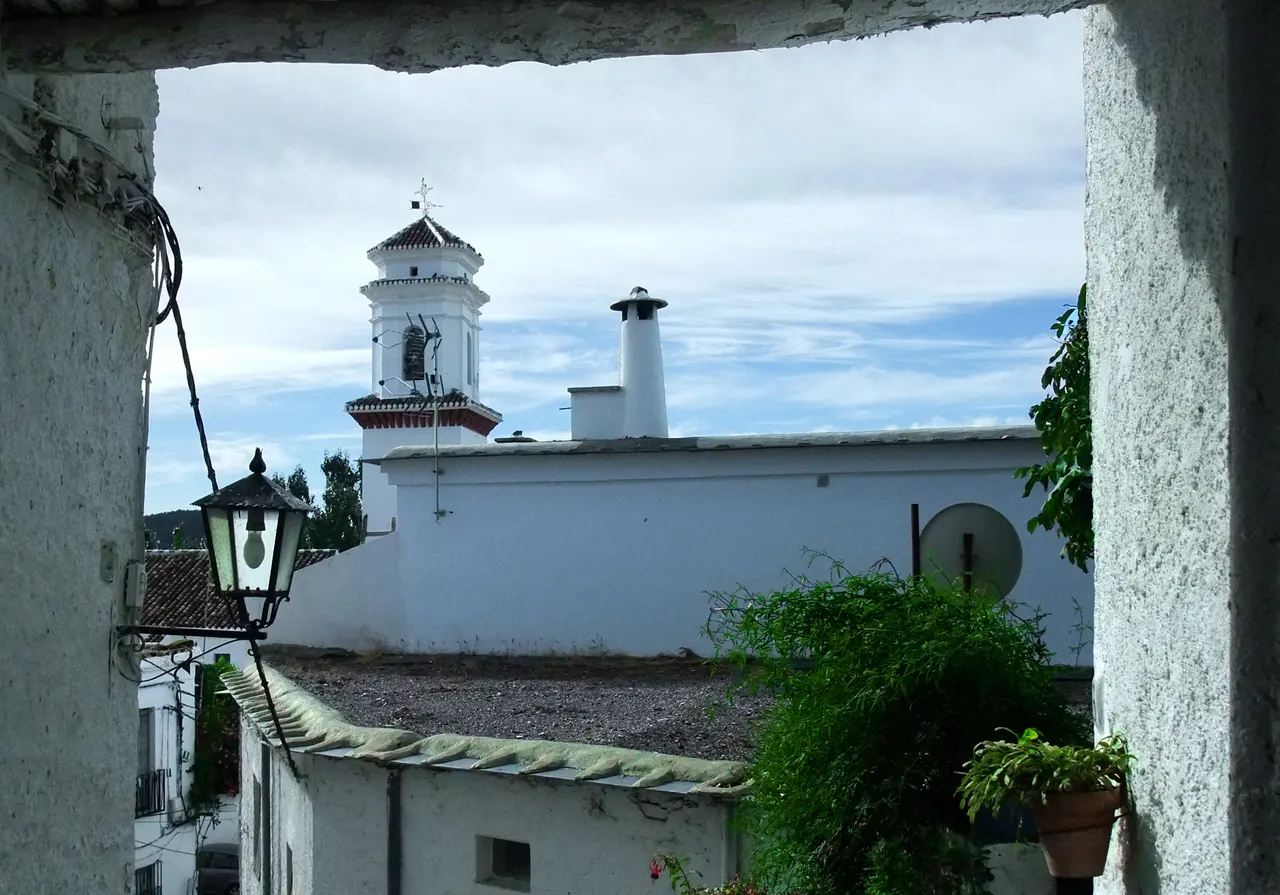
The municipal guide to the circular path explains flat roofs with lagoons, tinaos, terraces supported by stone walls and irrigation ditches. They are key to interpreting the landscape, in addition to the white facades.
In Mecina, the old schools house the Sierra Nevada and Alpujarra Study Center, CESNA, dedicated to meetings, exhibitions and cultural activities. Check their programming and access before organizing an interior visit.
Fountains, irrigation ditches and pools have local uses. Bring water to drink and check the drinking signs if you use a fountain. Respect irrigation and properties and avoid entering deposits.
The Fondales Bridge: the name and its history
The bridge crosses the Trevélez River outside the town. The Fondales file describes it as medieval, although it also uses the name “Roman Bridge.” The trail guide clarifies that this is its local name and that its construction would have been later, probably from the Islamic period.
It is advisable to preserve this difference between popular name and dating. If you want to get closer, confirm the path and its status; The bridge and the river require an exit outside the town, with terrain and slopes different from the urban promenade.
Hiking: choosing a specific route
The municipal program «7 towns, 7 routes» brings together proposals developed with IES Sulayr students and links the routes on Wikiloc. There are seven different routes:
| municipal route | Published tour | to choose |
|---|---|---|
| 1 | Pitres, Capilerilla, Gorda irrigation canal and Pitres. | It connects the capital and the highest core. |
| 2 | Pitres, Mecina, Mecinilla, Fondales, Ferreirola, Atalbéitar and Pitres. | Visit six towns; Capilerilla is out. |
| 3 | Pitres, Capilerilla and Aylacares road. | Check the route and return point. |
| 4 | Pitres, Gorda irrigation canal, recreational area and Pórtugos. | It leaves the municipality towards Pórtugos. |
| 5 | Pitres, Atalbéitar and Fuente Agria de Pórtugos. | Includes another destination outside of La Taha. |
| 6 | Mecina, escarihuela de Fondales, Cerro Corona, escarihuela de Panjuila and Ferreirola. | Check unevenness and state of the escarihuelas. |
| 7 | Pitres, junction of the GR-7, Capilerilla and Pitres. | Another proposal between Pitres and Capilerilla. |
They are different layouts. Route 2 does not include Capilerilla and route 6 incorporates escarihuelas; You should not treat them as a single circuit of seven towns. Some other proposals leave for Pórtugos.
Before leaving, consult the information and layout of the chosen route: distance, gradient, difficulty, crossings and return points. Check the signage and the status of the route and save the map to consult it without coverage.
Check the weather and adapt the plan to the available light and the group’s capacity. Bring water and appropriate footwear. If you travel with a stroller or wheelchair, check slopes, road surfaces, stairs and alternatives for the specific route.
How to organize a first visit
Start in Pitres and then choose another nucleus according to what you prefer to see: Chapel for fountains and era; Mecina and Mecinilla for architecture; Fundales if you have also prepared access to the river environment. If you are going to walk between towns, use an identified route and plan how to return to the arrival point.
With little time, concentrate the walk in a nucleus and leave time to eat. If you combine several towns by vehicle, prepare parking and access to each one. A complete walking route requires setting aside time to walk and return to the starting point.
How to Get to La Taha from Granada, Public Transport & Where to Stay
Transportation, food and contacts
The municipal transport page uses the Empalme de Pitres stop on its bus links. Check Alsa schedules and stations for your date and confirm exact stop, access to the center and last return. Separately organize the transfer to the other towns.
The City Council publishes these taxi contacts: Fernando Márquez, 659 111 745; Alpujatours, 654 520 140; and Salguero, 629 098 211 / 630 645 614. Arrange pickup, destination, availability and price. By car, check parking and access to the accommodation before entering the narrow streets.
The municipal gastronomy includes migas, Alpujarreño dishes, fennel and thistle stews, and pastries such as roscos and pestiños. Check seasonal dishes, opening, menu and dietary needs with the establishment you choose.
The La Taha City Council is at Plaza del Ayuntamiento, 1, 18414 Pitres, and is open at 958 766 061. Check routes, accesses and municipal resources before your trip. Its contact page also links to the electronic office for procedures with a digital certificate.
Sources
- City Hall: history and municipal fusion: https://lataha.es/ayuntamiento/historia/
- BOE: Decree 881/1972, published on April 12, 1972: https://www.boe.es/diario_boe/txt.php?id=BOE-A-1972-37645
- Town Hall: Pitres and its architecture: https://lataha.es/pueblo/pitres/
- Town Hall: Capilerilla: https://lataha.es/pueblo/capilerilla/
- City Council: Mecina and CESNA: https://lataha.es/pueblo/mecina/
- Town Hall: Mecinilla: https://lataha.es/pueblo/mecinilla/
- Town Hall: Fondales and its bridge: https://lataha.es/pueblo/fondales/
- Town Hall: Ferreirola: https://lataha.es/pueblo/ferreirola/
- Town Hall: Atalbéitar: https://lataha.es/pueblo/atalbeitar/
- Town Hall: circular path heritage: https://lataha.es/rutas/sendero-circular/
- City Hall: seven routes and links to their routes: https://lataha.es/rutas/7-pueblos-7-rutas/
- City Hall: transport and taxi contacts: https://lataha.es/horarios-de-autobuses-y-servicios-de-taxi/
- Alsa: consultation of schedules and stations: https://www.alsa.es/es/tu-viaje
- Town Hall: gastronomy: https://lataha.es/municipio/gastronomia/
- Town Hall: address and contact: https://lataha.es/contacto/
- BOE: original text of Decree 881/1972 in PDF: https://www.boe.es/boe/dias/1972/04/12/pdfs/A06510-06510.pdf
Hiking Trail & Village Day-Trip Calculator (Time & Budget)
Calculate real hiking duration, transport cost from Granada city and local meal budget:
Guided Tours, Free Walking Tours & Tickets in Granada
Book official guided tours, monument tickets, and day trips in Granada with instant confirmation and free cancellation.
Hotels & Stays in Granada
Check live availability, location map, and stays with free cancellation in Granada.