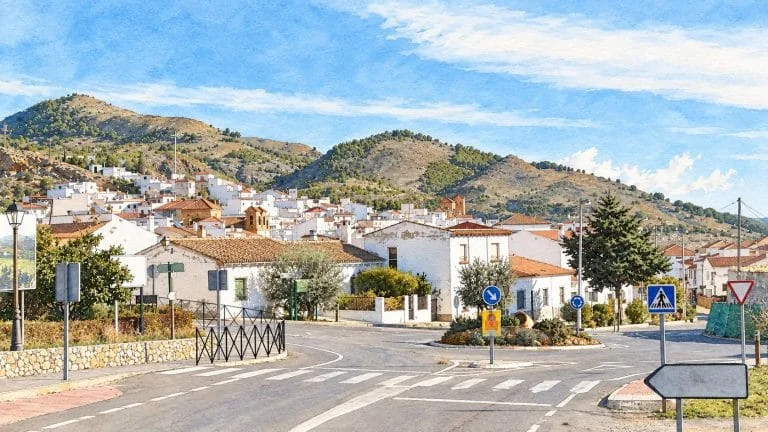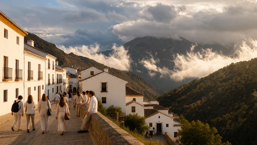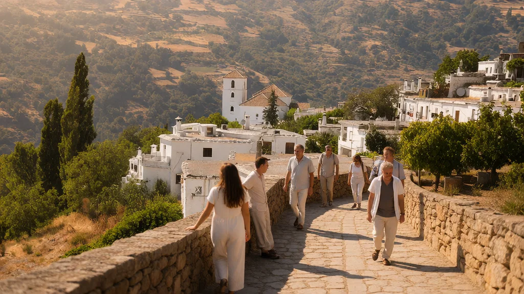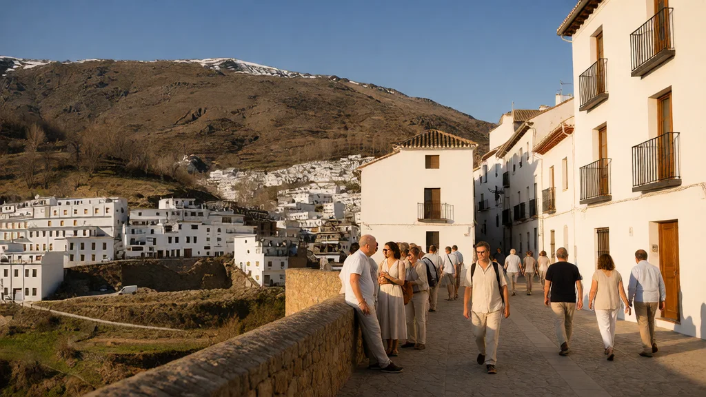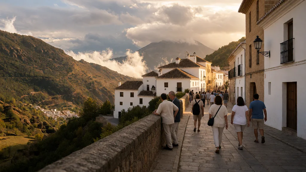
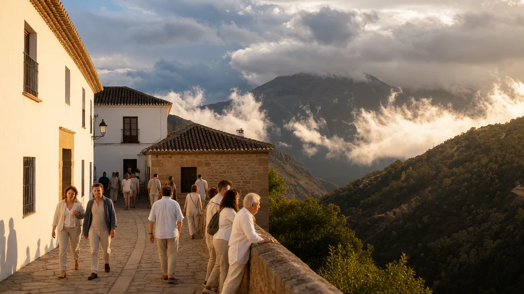
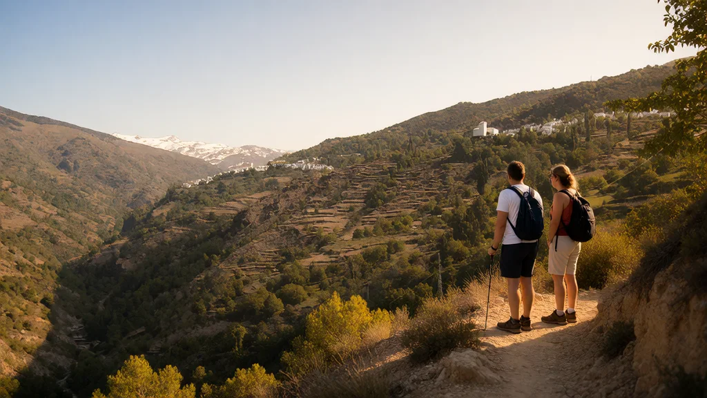
Capileira allows you to combine Alpujarran architecture, viewpoints and hiking in the Poqueira ravine. It is the highest of the three towns that form the group with Bubión and Pampaneira. To prepare for the visit, distinguish a walk through the urban area, a route through the ravine and a high mountain outing: each plan requires different time, equipment and transportation.
This guide brings together cultural visits, viewpoints, three trails and access options to the Sierra Nevada. It also explains how to organize parking, food, bus and return, so you can choose a tour suitable for your group.
Illustration of GranadaSmile by Capileira, based on a visual reference from the Granada Tourism gallery. Artistic representation of a snowy scene, without indicating the current weather conditions.
Capileira: information to organize the visit
- Location: Alpujarra of Granada, on the southern slope of the Sierra Nevada and on the Poqueira ravine.
- Core altitude: about 1,400 meters; AEMET places its municipal reference at 1,429 meters.
- Urban visit: historic center, viewpoints, church and museum, with slopes and cobblestone streets.
- Hiking: La Cebadilla, PR-A 69; Towns of Poqueira, PR-A 70; and Acequias del Poqueira, PR-A 23.
- Local information: Capileira City Council, telephone 958 763 051 and email capileira@dipgra.es, published in the municipal contact section. The announced information hours are Monday to Friday, from 10:00 a.m. to 2:00 p.m.; It is not equivalent to the museum’s opening hours. Check access, parking and opening of visits when they are decisive for your trip.
History and architecture: what to see in the town
Turismo de Granada relates the name of Capileira with a Latin root referring to a high place. Its historical summary places the nucleus in the Taha de Poqueira during the Nasrid period and explains the expulsion of the Moorish population and the subsequent repopulation after the Alpujarras rebellion that began in 1568.
Royal Decree 3235/1982, published on November 29, 1982, declared Capileira a historical-artistic complex in accordance with the delimitation of its annex. This recognition helps to understand the interest of the walk through its streets and homes.
Notice how the houses are staggered on the hillside and how the streets connect different levels. Turespaña highlights the homes with flat roofs and the steep layout of the core. It is best to travel slowly: short distances on the map may include slopes or steps.
- Terraos: flat roofs typical of Alpujarreño architecture; The launa is part of its traditional construction.
- Tinaos: covered spaces and overhangs between buildings that appear in the street network. Respect private access.
- Water and agricultural landscape: ditches, terraces and old roads help to interpret the relationship between the town and the ravine. The trails allow you to see that environment in more detail than an urban walk.
The municipal information also mentions two historic laundries. If you want to include them, ask about their location and access in the itinerary you are going to follow. For photographs, use public spaces and avoid going up to roofs, walls or private properties.
What to see in Capileira
1. Viewpoints of the urban area
The City Council lists viewpoints such as Tajo del Diablo, Perchel, Espeñuelas and Mentidero. You can choose two or three stops and combine them with the walk through the streets, instead of trying to visit all the points without checking where they are.
The Eras de Aldeire also appear as a viewpoint in the La Cebadilla brochure, near the return to Capileira. Choose the point based on its location with respect to your route and the access conditions. Visibility depends on clouds, light and weather; Don’t count on seeing the coast or the peaks at any time.
Puerto Molina and the area of the confluence of the rivers belong to plans for the mountain environment. Add your trip and return to the day’s calculation; don’t treat them as consecutive stops on a short walk downtown. The municipal list of viewpoints is used to identify the names and ask for specific access.
2. Church of Our Lady of the Head
The municipal page dedicated to the patron saint links the current configuration of the temple to the 18th century. It is a cultural and religious stop that you can combine with the historic center. Information from the City Council highlights its baroque altarpiece.
The City Council publishes visits from Wednesday to Sunday, from 10:00 a.m. to 2:00 p.m. and from 4:00 p.m. to 7:00 p.m., extended until 9:00 p.m. in summer. Confirm opening if you are traveling to enter: celebrations and other circumstances may affect your visit. For groups, provide the telephone number 698 454 085.
The tradition of the Virgen de la Cabeza has two annual events: the last Sunday of April and the second weekend of August, according to the patron saint’s page. Check the specific program if you want to attend; These traditional references do not fix all the acts of an edition.
3. Pedro Antonio de Alarcón Museum
The Pedro Antonio de Alarcón Museum of Arts and Customs of the Alpujarra is located on Mentidero street, s/n, in the old town hall. Granada Tourism describes two floors with belongings and utensils from Alpujarra life and customs. Its name pays homage to the Accitan writer.
It is an option to give context to the landscape you see outside: housing, work and daily life. Check opening, price and access conditions before reserving a fixed part of the day. The file provides the municipal telephone number 958 763 051; Don’t assume that church hours are also museum hours.
4. Walk through the streets and everyday spaces
Complete the visits with a tour between the surroundings of the church, Mentidero and the streets of the historic center. Look at the roofs, the covered steps and the adaptation of the homes to the slope. Leave room to rest and return to the vehicle or stop.
With a stroller or reduced mobility, ask for the specific section before entering a narrow street. If you are staying in the town, ask the establishment where to unload luggage and what walking route you should follow. Just because an accommodation appears nearby on the map does not guarantee level access.
Hiking: three different routes through the Poqueira
| Trail | Distance | Indicative time of sources | What to value |
|---|---|---|---|
| La Cebadilla · PR-A 69 | 7.5 km. | 3h30 on the panel; 4 hours in the brochure. | Medium difficulty and little shade. |
| Villages of Poqueira · PR-A 70 | 9.4 km. | 3h30 in the brochure. | Circuit with ups, downs and river crossings. |
| Poqueira ditches · PR-A 23 | About 16.3 km. | 6 hours on the tab; 8:30 a.m. on the panel. | long day; high difficulty on the current sheet. |
Times are estimates from linked documents, with differences between sources. Add stops and margin depending on pace, terrain and weather. Check map, signage and route status; A descriptive sheet does not report all the changes that may occur that day.
La Cebadilla: town and landscape of the ravine
The City Council identifies La Cebadilla as PR-A 69. The trail brochure describes the beginning in the Castillo neighborhood: first it gains altitude, passes through the Lugares irrigation canal and connects with the track towards the old town linked to the hydroelectric plant.
The route reaches the area where Toril and Naute meet and crosses the Poqueira. The return passes through the other slope, around the Abuchite farmhouse and the Abuchite bridge, before climbing towards Capileira and the Eras de Aldeire. Use the map in the brochure to prepare the complete circuit; Do not confuse the visit to the town with the entire route.
The document warns of little shade and recommends water and appropriate footwear. Bring the water you need and don’t assume that any source is drinkable. The buildings of the old town should not be treated as facilities open to internal visits.
Towns of Poqueira: Capileira, Bubión and Pampaneira
The Poqueira Towns brochure presents a 9.4 kilometer circuit with a start drawn in Pampaneira, passing through Bubión and Capileira, bridges and roads on the opposite side. The complete route includes ascents and descents; It is not equivalent to going down a single street between the three towns.
You can plan a linear section between locations, but prepare its route, length and return separately. If you walk down from Capileira, confirm in advance the transportation you will use to return. The bus only resolves this return if there is an expedition, a stop and seats suitable for the date and time you need. You can also arrange a pick-up or round-trip itinerary tailored to your group.
Acequias del Poqueira: a longer outing
The Board file describes a circular route of about 16.3 kilometers and high difficulty. The trails panel identifies it as PR-A 23 and publishes a time greater than the record. Book a day of hiking and prepare the effort with the map, the slopes and your experience.
Do not use the La Cebadilla numbers for this route: they share part of the environment, but the irrigation ditch route continues higher up. Check the forecast and warnings, take guidance and decide in advance when to return. If you are looking for a short trip, choose another plan instead of starting a long day without margin.
High mountains: Hoya del Portillo, Poqueira and Mulhacén
Capileira is an access to the southern slope of the Sierra Nevada. To climb Mulhacén, prepare a complete mountain route: approach, ascent, descent and return transportation. Visiting Capileira or reaching an access point does not imply having the necessary preparation to reach the summit.
From Hoya del Portillo to the refuge
The Refugio Poqueira file publishes for the Hoya del Portillo–refuge section 7.7 kilometers, +526 meters and between 2 and 3 hours of climbing. These data reach the refuge: they do not include an ascent to Mulhacén or the return.
Check the access and parking conditions before using the track towards Hoya del Portillo. Do not plan a private vehicle route to the summit. If you depend on the shelter to sleep or eat, expressly confirm the services available. Its safety sheet from October 1, 2026 indicates an open bivouac and a guarded area with opening soon; The bivouac does not guarantee the services of a saved stay.
Before depending on the shelter: its official website maintains a closure notice for works, consulted on October 7, 2026. Confirms the conditions and eventual reopening at 958 343 349; the specific notice takes precedence over the general annual opening heading.
The sheet places Hoya del Portillo at 2,150 meters, about 13 kilometers above Capileira, and conditions the tourism approach to the absence of snow. Please note that in winter the snow can cut off access before the parking lot and that this itinerary is not the same plan as a summer outing. Don’t turn the 2–3 hour figure into a forecast for winter conditions or cut corners across ravines: prepare your route and check the conditions before setting off.
SIAC Sur: minibus with interpretation
The Junta de Andalucía describes the Altas Cumbres Sur Interpretation Service for summer and autumn, departing from Capileira and arriving at Alto del Chorrillo, passing through Puerto Molina. The service includes interpretation during the minibus tour.
Check the date of operation, places, price, departure point and return time before preparing an excursion that depends on it. The published reservation telephone number is 671 564 406. The Board provides siacsur.amaya@juntadeandalucia.es for the Capileira information point and 958 980 246 for Public Use of the Natural Space. Confirm the operation: the service may be modified or suspended due to weather or safety. The interpreter guide of the service does not provide accompaniment on your subsequent ascent on foot.
To compare both summits and the access sections, consult the route guide to Veleta and Mulhacén. Check the mountain forecast and park notices; The forecast for the urban center of Capileira does not by itself describe the conditions of the summits.
What to eat and how to choose where to stop
Granada Tourism highlights the Alpujarreño dish, with poor-style potatoes, egg, ham, marinated loin and sausages, in addition to the choto capilurrio and the fennel stew. Look for these dishes on the menus and ask about the preparation of each establishment.
For a meal after walking, confirm kitchen hours and reserve if you need a specific table. Check serving sizes, ingredients, allergens and price. A local recipe does not require all restaurants to serve the same combination, quantity or accompaniment.
If you buy bread, artisan products or sweets, ask about their preparation and conservation. If you leave early on the route, bring food and water from the beginning: a store or restaurant in the town does not guarantee supply during the route.
How to get there, park and return
By car from Granada
The usual approach is organized along the A-44 towards the access to the Alpujarra, continuing through the surroundings of Lanjarón and Órgiva and the A-4132. The last access to Capileira uses the A-4129. Calculate the route to the specific parking lot or accommodation, allowing for the mountain section and stops.
When you arrive, follow the parking signs and read the rates and restrictions for the chosen location. Do not assume that all spaces are free or that arriving at a certain time guarantees a place. If you need access to the accommodation with luggage or due to mobility, resolve it beforehand with the establishment.
By bus
Check Alsa for the origin Granada and destination Capileira for the date of the trip. Check stop, arrival, return and ticket conditions. Avoid basing the plan on a table with no proven validity: the municipal page maintains schedules identified as 2025.
If you combine several towns on foot, check separately for the bus from the point where you will end. The existence of a connection with Granada does not guarantee a return between towns at any time. If the last expedition doesn’t fit, change the route or arrange another transportation before leaving.
How much time to spend and practical advice
For a half-day visit: you can propose a walk through the center, two viewpoints and an interior visit if it is open. Adjust the plan to the slopes, the group’s pace and the time you have until your return.
For a full day: choose between extending the cultural visit to another location or taking a trail appropriate to your experience. La Cebadilla requires several hours of travel; museum, food and driving add time. Avoid fitting all the routes and three towns into the same day.
With one or two nights: you can separate urban visits and hiking. Book accommodation based on access, luggage, food and transportation. A high mountain ascent requires proper planning and a margin according to its conditions.
- Footwear and luggage: the cobblestones and slopes recommend good grip and easy-to-transport luggage.
- Time: consult AEMET for Capileira and prepare clothes according to the forecast of your visit. For mountains, also check their specific prediction.
- Children and mobility: choose specific sections and breaks; Don’t consider every trail or street suitable for a stroller.
- Everyday services: confirm store hours, pharmacy and cash availability if you depend on them; Pack your supplies before a long route.
- Health care: the SAS identifies an auxiliary office in Capileira with limited hours. Consult the file and do not assume 24-hour in-person attention. For an emergency, call 112.
Frequently asked questions
What to see in Capileira without hiking?
You can combine traditional streets and architecture, viewpoints of the town, the church and the Pedro Antonio de Alarcón Museum. Confirm the openings and prepare a route according to the slopes and mobility of the group.
Is Cebadilla PR-A 69 or PR-A 70?
La Cebadilla is PR-A 69. The City Council identifies Pueblos del Poqueira as PR-A 70. They are different routes, with 7.5 and 9.4 kilometers published for their complete circuits.
Can you walk down to Bubión and Pampaneira?
It is possible to prepare a section between the towns, but it is not equivalent to the complete circuit of Poqueira Towns. Check the route and organize your return; Do not count on a bus without confirming the issuance of your date.
Can you go up to Mulhacén by car?
Do not plan to reach the summit with a private vehicle. Check the conditions of access to Hoya del Portillo and, if you want to use the SIAC Sur, date of operation, places and return. After the transport there is a route on foot.
Does the route to the Poqueira Refuge include the summit?
No. The 7.7 kilometers and 2–3 hours published from Hoya del Portillo correspond to the ascent section to the refuge. The ascent to Mulhacén and the descent require additional time and preparation.
How long does it take to visit Capileira?
Half a day can be used for a selected urban walk. If you add a trail, another location or several interior visits, reserve more time and also calculate food and return. The high mountains require their own plan.
Sources
- Capileira City Council: visits, contacts and services: https://capileira.es/
- Granada Tourism: history and gastronomy of Capileira: https://www.turgranada.es/es/municipios/capileira
- BOE: declaration of historical-artistic complex, Royal Decree 3235/1982: https://www.boe.es/boe/dias/1982/11/29/pdfs/A32809-32809.pdf
- Turespaña: architecture and visits in Capileira: https://www.spain.info/es/destino/capileira/
- Capileira City Council: list of viewpoints: https://capileira.es/el-columpio-a-1-500-metros-de-altitud-en-granada/
- Capileira Town Hall: church, patron saint and traditional festivals: https://capileira.es/virgen-de-la-cabeza-capileira/
- Granada Tourism: Pedro Antonio de Alarcón Museum: https://www.turgranada.es/es/pois/museo-pedro-antonio-de-alarc%C3%B3n
- Official brochure: La Cebadilla, published by the City Council: https://capileira.es/wp-content/uploads/2023/12/PRA69.pdf
- Official brochure: Poqueira Towns, published by the City Council: https://capileira.es/wp-content/uploads/2023/12/pra-70.pdf
- Junta de Andalucía: panel of La Cebadilla and Acequias del Poqueira trails: https://www.juntadeandalucia.es/medioambiente/portal/documents/20151/47779045-8fc8-150c-14d0-1e926c6a8563
- Junta de Andalucía: Acequias del Poqueira file: https://www.juntadeandalucia.es/medioambiente/portal/landing-page/-/asset_publisher/4V1kD5gLiJkq/content/acequias-del-poqueira/255035
- Junta of Andalusia: Sierra Nevada and SIAC Sur: https://www.juntadeandalucia.es/medioambiente/portal/landing-page/-/asset_publisher/4V1kD5gLiJkq/content/sierra-nevada/255035
- Poqueira Refuge: route from Hoya del Portillo: https://refugiopoqueira.com/por-la-hoya-del-portillo/
- Poqueira Refuge: safety sheet from October 1, 2026: https://refugiopoqueira.com/wp-content/uploads/2026/10/FICHA-DE-SEGURIDAD-1-10.pdf
- AEMET: municipal prediction for Capileira: https://www.aemet.es/es/eltiempo/prediccion/municipios/capileira-id18042
- Andalusian Health Service: Capileira auxiliary office: https://www.sspa.juntadeandalucia.es/servicioandaluzdesalud/el-sas/servicios-y-centros/informacion-por-centros/23689
- Alsa: consultation of tickets and schedules by date: https://www.alsa.es/
- Poqueira Shelter: notice of works and current contact: https://refugiopoqueira.com/
Hiking Trail & Village Day-Trip Calculator (Time & Budget)
Calculate real hiking duration, transport cost from Granada city and local meal budget: